
Libre
Chart Transit
8 years ago
by Chart
1.0.3


Libre
Chart Terminal
8 years ago
by Chart
1.0.1

$ 4.99
Star Lake NY GPS fishing chart
14 years ago
by Flytomap
5.5
Flytomap is a valid and interesting alternative, Benetti Yachts
Top Ten since 2008
Featured in : On...
$ 4.99
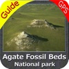
Agate Fossil Beds National Monument GPS chart
14 years ago
by Flytomap
5.5
“Download any FlytoMap application for Free! By purchasing FlytoMap All-in-One App.”
!! Watch "Flyt...

$ 4.99
Chaco Culture National Historic Park GPS Chart
14 years ago
by Flytomap
5.5
“Download any FlytoMap application for Free! By purchasing FlytoMap All-in-One App.”
!! Watch "Flyt...

$ 4.99
Lake Oahe - Dakota GPS fishing chart & map offline
14 years ago
by Flytomap
5.5
!! TRY before BUY !!!
Try now the new FlyToMap web viewer to see all available maps worldwide !!! V...

Libre
Flightwise Flight Planner & Chart Explorer
14 years ago
by Aviation Data Systems, Inc
4.0

$ 4.99
Aiguestortes i Estany de Sant Maurici NP GPS chart
13 years ago
by Flytomap
5.5
!! TRY before BUY !!!
Try now the new FlyToMap web viewer to see all available maps worldwide !!! V...

$ 14.99
Miami to Key West GPS HD Chart
13 years ago
by Flytomap
5.7
Flytomap lanza al mercado la mejor carta oficial actualizada con rampas, puertos, pecios, puntos de...

$ 4.99
Malta - GPS offline chart & spot Navigator
13 years ago
by Flytomap
5.5
!! TRY before BUY !!!
Try now the new FlyToMap web viewer to see all available maps worldwide !!! V...

$ 5.99
Martha's Vine & Nantuket chart
13 years ago
by Flytomap
5.5
Flytomap lanza al mercado la mejor carta oficial actualizada con rampas, puertos, pecios, puntos de...

$ 7.99
Djerba (Tunis) HD GPS Chart
13 years ago
by Flytomap
5.5
Flytomap lanza al mercado la mejor carta oficial actualizada con rampas, puertos, pecios, puntos de...

$ 9.99
Boating New Caledonia HD chart
8 years ago
by Flytomap
5.7
Flytomap lanza al mercado la mejor carta oficial actualizada con rampas, puertos, pecios, puntos de...
$ 1.99
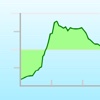
Elevation Chart - Draw Profile View by Touchs
13 years ago
by Nianliang Mo
2.3

$ 3.99
Pin Pin - Pinyin Chart, Quizzes, and Lessons
11 years ago
by Pin Pin LLC
1.2

$ 9.99
Aqua Map US - Marine Chart GPS
10 years ago
by GEC s.r.l.
8.3.5
Una aplicación para satisfacer todas sus necesidades de Pesca y Náutica, desarrollado con la ayuda d...

Libre
NaVida USA
10 years ago
by Electronic Chart Centre
1.1.2

$ 12.99
British Virgin Islands Chart Briefing
10 years ago
by NauticEd Sailing School
1.0.4

Libre
My Tide Times - Tables & Chart
10 years ago
by JRustonApps B.V.
6.5.2
Mis Horarios de Mareas es la única aplicación de tablas de mareas que necesitarás. Ya sea para surfe...

Libre
Chhatrapati Shivaji Mumbai BOM Airport. Flights, car rental, shuttle bus, taxi. Arrivals & Departures.
10 years ago
by Rubicone sp. z o.o.
1.0
Airport & Guía de Aerolíneas es un multi-lenguaje inteligente y fácil de usar de vuelo y la planific...

Libre
Målebåter
10 years ago
by Electronic Chart Centre
1.1.0

$ 2.99
My Tide Times Pro - Tide Chart
10 years ago
by JRustonApps B.V.
6.5.1
Mis Horarios de Mareas Pro es la única aplicación de tablas de mareas que necesitarás. Ya sea para s...

Libre
O que tem de bom
9 years ago
by Adihelen Melo
1.2.3
¿O TEM DE BOM? -¿QUÉ ES BUENA?
Lo que es bueno para ver, hacer y disfrutar en Brasil. O QUE TEM DE...

$ 5.99
Florida GPS Nautical Chart Pro
10 years ago
by MapITech
5.0
MapiTech launches on the market the best official up-to-date NOAA RNC (raster) combined with S57 nau...
Libre
Smart Chart AIS
9 years ago
by Team Augmented Reality, Inc.
1.4

$ 5.99
Netherlands GPS nautical Chart
9 years ago
by MapITech
5.0.1
Mapitech lanza al mercado la mejor carta oficial del NOAA - NIMA RNC y actualizada con rampas, puert...

$ 6.99
Greece West Nautical Chart HD
9 years ago
by MapITech
5.0
Mapitech lanza al mercado la mejor carta oficial del NOAA - NIMA RNC y actualizada con rampas, puert...

$ 9.99
Spain Atlantic GPS Chart Pro
9 years ago
by MapITech
5.0
Mapitech lanza al mercado la mejor carta oficial del NOAA - NIMA RNC y actualizada con rampas, puert...

$ 6.99
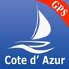
Cote d'Azur Nautical Chart pro
9 years ago
by MapITech
5.0
Mapitech lanza al mercado la mejor carta oficial del NOAA - NIMA RNC y actualizada con rampas, puert...
$ 3.99
French Riviera Nautical Chart
9 years ago
by MapITech
5.0
Mapitech lanza al mercado la mejor carta oficial del NOAA y actualizada con rampas, puertos, pecios,...

$ 4.99
Greece West GPS Nautical Chart
9 years ago
by MapITech
5.0.1
Mapitech lanza al mercado la mejor carta oficial del NOAA y actualizada con rampas, puertos, pecios,...

$ 3.99
Spain Atlantic Nautical Chart
9 years ago
by MapITech
5.0
Mapitech lanza al mercado la mejor carta oficial del NOAA y actualizada con rampas, puertos, pecios,...

$ 5.99
Spain Mediterranean GPS Chart
9 years ago
by MapITech
5.0
Mapitech lanza al mercado la mejor carta oficial del NOAA - NIMA RNC y actualizada con rampas, puert...

$ 19.99
Channel Is. Nautical Chart Pro
9 years ago
by MapITech
5.0
MapiTech launches on the market the best official up-to-date NOAA RNC (raster) combined with S57 nau...

$ 12.99
Channel Is. GPS Nautical Chart
9 years ago
by MapITech
5.0.1
MapiTech launches on the market the best official up-to-date NOAA RNC (raster) combined with S57 nau...
$ 4.99
Le Havre - Dunkerque GPS Chart
9 years ago
by MapITech
5.0.1
Mapitech lanza al mercado la mejor carta oficial del NOAA y actualizada con rampas, puertos, pecios,...

$ 12.99
London - Thames Nautical Chart
9 years ago
by MapITech
5.0.1
MapiTech launches on the market the best official up-to-date NOAA RNC (raster) combined with S57 nau...

$ 19.99
UK Ireland Netherlands Chart
9 years ago
by MapITech
5.0.2
Mapitech lanza al mercado la mejor carta oficial del NOAA y actualizada con rampas, puertos, pecios,...

$ 6.99
Euskadi GPS Nautical Chart Pro
9 years ago
by MapITech
5.0
Mapitech lanza al mercado la mejor carta oficial del NOAA y actualizada con rampas, puertos, pecios,...

$ 6.99
Galicia GPS Nautical Chart Pro
9 years ago
by MapITech
5.0
Mapitech lanza al mercado la mejor carta oficial del NOAA y actualizada con rampas, puertos, pecios,...