libre
AtoB Distance Calculator Free - easy and fast air or car route measurement from A to B for travel and more
12 years ago
by Bernhard Obereder
1.2.6

libre
Partner Maps
12 years ago
by Partner Software
2.0.6

libre
Sriwijaya Air
6 years ago
by PT. Sriwijaya Air
1.0

libre
Panama Open Air
5 years ago
by Panama Open Air GmbH
3.2

libre
KRISTAL.air
4 years ago
by KRISTAL AIR CONTEST
1.0.0

$ 8.99
E6B Aviation Calculator
15 years ago
by Aviation Mobile Apps, LLC.
2.4.1

$ 4.99
Cold Air Correction
15 years ago
by PunkStar Studios
1.4

$ 4.99
iTrailMap 3D (ski and snowboard trail maps)
15 years ago
by Big Air Software, LLC
2.1

libre
Air Navigation Pro
15 years ago
by Xample Sarl
8.3.207
PLUS DE TEMPS A VOLER, MOINS A PLANIFIER !
- Tout ce dont vous avez besoin pour voler dans le monde...

libre
Air Navigation Free
15 years ago
by Xample Sarl
2.2.0

$ 0.99
Boston GPS Tour
15 years ago
by Big Air Software, LLC
1.0

$ 0.99
Washington DC - GPS Tour
15 years ago
by Big Air Software, LLC
1.0

$ 0.99
Park Maps
15 years ago
by Big Air Software, LLC
1.1

$ 0.99
Holding Pattern Calculator
15 years ago
by CodeBurners
2.0

$ 0.99
Gas Mix - 2 Cycle Fuel Mix Calculator
15 years ago
by Ultra Software Solutions, LLC
5.0.0

$ 10.99
Air Navigation Standard
14 years ago
by Xample Sarl
5.1.2
$ 2.99
CFI Tools Crosswind Calculator
14 years ago
by Edgemont Systems
1.12

$ 0.99
Geo Planimeter - Area & Distance Calculator
14 years ago
by ROUGE41
2.1

$ 28.99
MiRC Sailing Handicap Calculator
14 years ago
by Alliants Ltd
v1.03

$ 4.99
Air Distance
13 years ago
by Labrum Co.
2.1.1

$ 3.99
Air Board HD
13 years ago
by Marco Guerra
5.4
$ 5.99
Air Board EFIS
12 years ago
by Marco Guerra
4
libre
Masqott Air Report
12 years ago
by Twinbo snc di Marcheselli Fiammetta e Mantovani Alex
1.3
Air Report est une station météo nomade complète: Pression atmosphérique, Altitude, Température, Hum...

libre
Sentient Air Nav VFR
11 years ago
by Sentient Software
2.91

libre
ThurGIS
11 months ago
by Kaden & Partner AG
3.2.1

libre
Masqott Air Track
12 years ago
by Twinbo snc di Marcheselli Fiammetta e Mantovani Alex
1.4
Air Track est une application pro pour la randonnée , le VTT, , le parapente et autres activités out...

libre
Airport Wayfinder
11 years ago
by Air Travel Video Technologies, LLC.
1.0

libre
twayair
11 years ago
by Tway Air Co., Ltd.
4.0.6

$ 4.99
Air Webcams HD Europe
11 years ago
by SEPT MILLE SARL
1.3
Air Webcams on your iPad is listing webcams located on European Airfields as well as the METAR and T...

$ 4.99
Air Webcams Europe
11 years ago
by SEPT MILLE SARL
1.3
Air Webcams Europe
Airfield Webcams on your iPhone is listing webcams located on European airfield...

libre
Sunrise sunset Calculator
11 years ago
by Auke Valk
1.2

$ 2.99
Paris Offline Map, Metro Air
11 years ago
by Green Lake Technology Ltd
4.5
Paris Offline Map est votre compagnon de voyage idéal : Une carte de la ville, un plan du métro, et...
$ 0.99
Distance - Bearing Calculator
11 years ago
by Joe Scrivens
1.2
A handy calculator to determine the distance and bearing between two known co-ordinated points. Som...
$ 0.99
Coordinate calculator
11 years ago
by Joe Scrivens
1.2
A handy calculator to determine the new coordinates of a point using a known distance and bearing....
$ 1.99
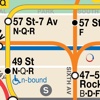
NYC Bus Map Calculator & Alerts
11 years ago
by Covariance Technologies, LLC
1.1.20130818
- Officially licensed NYC subway map (Manhattan, Brooklyn, Bronx, Queens, Staten Island)
- Best map...

$ 2.99
NYC Subway & Bus Map Calculator & Alerts
11 years ago
by Covariance Technologies, LLC
1.1.20130828
- Officially licensed NYC subway and bus maps for all boroughs (Manhattan, Brooklyn, Queens, Bronx,...

libre
Coordinates Distance Calculator
11 years ago
by Juan Mauricio Padilla Villarreal
2.0
libre
Military CYPRES Calculator
11 years ago
by Joe Lewis
3.5.0
$ 1.99
Nautical Calculator mariners
11 years ago
by VIDUR
2.3

$ 0.99
Map Calculator tool
11 years ago
by Dima Bart
2.0