
livre
EFB - Charts and Weather for Aviation
13 years ago
by GlobalNavSource
3.6
[Mandatory Update: Version 3.6 is a mandatory update for all pilots.]
EFB (Electronic Flight Bag)...


livre
iChart - Solent - Nautical Charts for iPhone and iPad
11 years ago
by malcolm deas
1.20

livre
iChart - Firth of Clyde - Nautical Charts for iPhone and iPad
11 years ago
by malcolm deas
1.20

livre
iChart - Thames Estuary - Nautical Charts for iPhone and iPad
11 years ago
by malcolm deas
1.20

livre
iChart - Anglesey and Lleyn Peninsula - Nautical Charts for iPhone and iPad
11 years ago
by malcolm deas
1.20

livre
iChart - Falmouth to Plymouth - Nautical Charts for iPhone and iPad
11 years ago
by malcolm deas
1.20

livre
iChart - West Coast of Scotland - Nautical Charts for iPhone and iPad
11 years ago
by malcolm deas
1.20

$ 19.99
Lido/iRouteManual - Aeronautical Charts for Preflight Briefing and Inflight Use
13 years ago
by Lufthansa Systems
1.3.9

$ 4.99
Grampians NP GPS and outdoor charts with guide
8 years ago
by Flytomap
5.5

livre
iChart - Channel Islands - Nautical Charts for iPhone and iPad
11 years ago
by malcolm deas
1.20

livre
iChart - Firths of Forth & Tay - Nautical Charts for iPhone and iPad
11 years ago
by malcolm deas
1.20

livre
iChart - Bristol Channel - Nautical Charts for iPhone and iPad
11 years ago
by malcolm deas
1.20

livre
iChart - Chichester to Dungeness - Nautical Charts for iPhone and iPad
11 years ago
by malcolm deas
1.20

livre
iChart - Weymouth to The Needles - Nautical Charts for iPhone and iPad
11 years ago
by malcolm deas
1.20
livre
iChart - Plymouth to Bill of Portland - Nautical Charts for iPhone and iPad
11 years ago
by malcolm deas
1.20

livre
Universal® Mobile: Aviation Weather, Flight Planning, Jet Fuel Pricing and Flight Scheduling
12 years ago
by Universal Weather and Aviation, Inc.
2.4

livre
Lido/Enroute - Aeronautical Enroute Charts for Preflight Briefing and Inflight Use
11 years ago
by Lufthansa Systems
1.3.2
$ 22.99
Marine Navigation - Lake Depth Maps - USA - Offline Gps Nautical Charts for Fishing, Sailing and Boating
11 years ago
by Bist LLC
58.0.0

$ 25.99
Marine Navigation - Canada - Offline Gps Nautical Charts for Fishing, Sailing and Boating
11 years ago
by Bist LLC
57.0.0

livre
GAS - Gather and Save
11 years ago
by Gather And Save Inc.
1.0.3

livre
Skipper ~ NOAA Marine Charts, ActiveCaptain, Nautical Weather, and Tides
10 years ago
by TrailBehind
3.0
Skipper is mobile charts done right. A seamless chart-plotter, with data synced across all of your d...

livre
Green and Yellow Cab
10 years ago
by Green Cab and Yellow Cab Companies
6.9.0

livre
SmartPlates & Charts – Geo-Ref Maps and Procedures
10 years ago
by Seattle Avionics, Inc.
1.1
$ 4.99
Aqua Map Florida - Marine GPS Offline Nautical Charts for Fishing, Boating and Sailing
10 years ago
by GEC s.r.l.
5.5
An app to satisfy all your Fishing and Boatings needs, developed with the help of professional fishe...
$ 4.99
Aqua Map California - Marine GPS Offline Nautical Charts for Fishing, Boating and Sailing
10 years ago
by GEC s.r.l.
5.5
An app to satisfy all your Fishing and Boatings needs, developed with the help of professional fishe...
$ 4.99
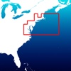
Aqua Map New England - coast from Maine to Connecticut - Marine GPS Offline Nautical Charts for Fishing, Boating and Sailing
10 years ago
by GEC s.r.l.
5.5
An app to satisfy all your Fishing and Boatings needs, developed with the help of professional fishe...
$ 4.99
Aqua Map Cape Cod to Chesapeake Bay - Marine GPS Offline Nautical Charts for Fishing, Boating and Sailing
10 years ago
by GEC s.r.l.
5.5
An app to satisfy all your Fishing and Boatings needs, developed with the help of professional fishe...
$ 4.99
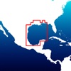
Aqua Map Alabama to Texas - Marine GPS Offline Nautical Charts for Fishing, Boating and Sailing
10 years ago
by GEC s.r.l.
5.5
An app to satisfy all your Fishing and Boatings needs, developed with the help of professional fishe...

$ 4.99
Aqua Map Oregon and Washington - Marine GPS Offline Nautical Charts for Fishing, Boating and Sailing
10 years ago
by GEC s.r.l.
5.5
An app to satisfy all your Fishing and Boatings needs, developed with the help of professional fishe...
$ 2.99
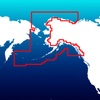
Aqua Map Alaska - Marine GPS Offline Nautical Charts for Fishing, Boating and Sailing
10 years ago
by GEC s.r.l.
5.5
An app to satisfy all your Fishing and Boatings needs, developed with the help of professional fishe...
$ 2.99
Aqua Map Hawaii - Marine GPS Offline Nautical Charts for Fishing, Boating and Sailing
10 years ago
by GEC s.r.l.
5.5
An app to satisfy all your Fishing and Boatings needs, developed with the help of professional fishe...

$ 1.99
NOAA Buoy and Tide Data
14 years ago
by Verona Solutions, LLC
8.6

$ 19.99
Charts&Tides (US Great Lakes)
15 years ago
by Navimatics Corporation
4.7.13203

$ 0.99
Basic GPS (Now with UTM, MGRS, and Email)
15 years ago
by Clever Applications LLC
3.0.1

$ 4.99
iTrailMap 3D (ski and snowboard trail maps)
15 years ago
by Big Air Software, LLC
2.1

$ 9.99
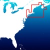
US East Charts Texas to Maine
15 years ago
by Flytomap
5.7

livre
WiFi
15 years ago
by True Digital Content And Media Company Limited
2.6

$ 9.99
Minnesota Lakes Fishing Charts
15 years ago
by Flytomap
5.9.1

livre
New York City Maps - NYC Subway and Travel Guides
15 years ago
by Networking 2.0
6.5
A DERRADEIRA APLICAÇÃO DE TRÂNSITO dá-lhe acesso a todos os mapas de metro, autocarro e comboio e gu...

livre
London City Maps Lite - Discover LON with Tube, Bus, and Travel Guides.
15 years ago
by Networking 2.0
6.3
A DERRADEIRA APLICAÇÃO DE TRÂNSITO dá-lhe acesso a todos os mapas de metro, autocarro e comboio e gu...