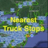

Live Street Map View for Truck Stops - Best App for Truck Stops Search at App Store analyse
follow appEstimation application downloads and cost
Description
NOTE: This app is not affiliated or endorsed by any web site. This app is developed based upon customized database, Transit API, Street Map View API, Foursquare API and Yelp services etc. The purpose of this API is to integrate a variety of services into your daily life especially during your trip.
Offline support is built-in for the locations across US and Canada.
- Free version has limited features.
- Purchase the full version to remove Ads and enable full features.
- Full version has better algorithm to get the street view or map view.
- Integrate the list view
- list the POI by distance
- Direction icon with precise Bearing to the POI
- Trip Planner to the POI
- By car, walk or public transportation
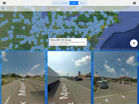
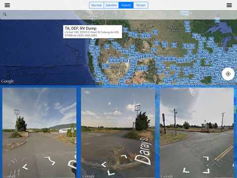
- When the app is launched, it will use your current location and display nearby Truck Stops.
- Move the map around to find Truck Stops.
- Click on an location to see the street map views (if applicable and free version has only one street map view). Click on the "Street map view button" to see full screen street map view.
- From the left sidebar, you can select a state. Then you can select a location from the right bar side (paid version only)
- Click on the marker info window or the "Navigation" button to start the navigation from your current location.
- Click on the "unlock" button for the in-app purchase.
Read more
Offline support is built-in for the locations across US and Canada.
- Free version has limited features.
- Purchase the full version to remove Ads and enable full features.
- Full version has better algorithm to get the street view or map view.
- Integrate the list view
- list the POI by distance
- Direction icon with precise Bearing to the POI
- Trip Planner to the POI
- By car, walk or public transportation
- When the app is launched, it will use your current location and display nearby Truck Stops.
- Move the map around to find Truck Stops.
- Click on an location to see the street map views (if applicable and free version has only one street map view). Click on the "Street map view button" to see full screen street map view.
- From the left sidebar, you can select a state. Then you can select a location from the right bar side (paid version only)
- Click on the marker info window or the "Navigation" button to start the navigation from your current location.
- Click on the "unlock" button for the in-app purchase.
Live Street Map View for Truck Stops - Best App for Truck Stops Search screenshorts


ASO analyse Live Street Map View for Truck Stops - Best App for Truck Stops Search app for iPhone and iPad
No search terms founded
Competitors of Live Street Map View for Truck Stops - Best App for Truck Stops Search application
Other apps from Calvin Chen


Similar apps