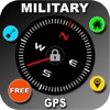
Military Survival GPS - Land Nav Compass, Tactical MGRS Grid Tool and Altimeter at App Store analyse
follow appEstimation application downloads and cost
Description
"LOST" isnt in our vocabulary and it shouldnt be in yours either!
Land navigation has never been easier. Plug in your GRID and youre good to go. Then just follow the compass to your point!
Military Survival GPS is one of the worlds first land navigation apps built specifically with hikers, survivalists and hunters in mind. Our advanced navigation platform allows users to be guided back to set waypoints using real time compass feedback that displays multiple waypoints at a time right on the compass!
There is NO NEED to buy an expensive GPS or backtrack device. Simply download our app, and youll always have your GPS with you!
Get real time 10 digit grids (MGRS) from any location with no internet needed!
Visually see your waypoints on your compass and see the direction and distance to them (your compass will literally lead you right to your set waypoints and tell you the distance to them)
Military Survival GPS provides live location status in 16 different forms and is updated every 3 seconds.
MAIN FEATURES INCLUDE:
-View your position in 16 different GPS coordinate types!
-Ability to manually enter in MGRS grids for land nav points, objectives or caches.
-Built Low light (no illumination) settings and for bright light usage
-Survival Military Compass with N,S,E,W and reference marks
-Advanced Azimuth Lock Feature (never loose an azimuth)
-Set waypoints and view them right on your compass.
-Get exact distance to your waypoints
-Waypoints get larger as you get closer to the point
-View waypoints in a list to keep organize and easily edit waypoint names
-View all points and current location on a map.
-3 different map types including (driving, satellite and hybrid)
-View Distance moved, speed and altitude (altimeter).
-DOZENS OF OTHER FEATURES INCLUDED!!
GPS TYPES INCLUDE:
-MGRS (Military Grid Reference System)
-MGRS 10 digit grid (1m accuracy)
-MGRS 8 digit grid (10m accuracy)
-MGRS 6 digit grid (100m accuracy)
-MGRS 4 digit grid (1000m accuracy)
-MGRS 10 digit grid "Figures Only" (1m accuracy)
-MGRS 8 digit grid "Figures Only" (10m accuracy)
-MGRS 6 digit grid "Figures Only" (100m accuracy)
-MGRS 4 digit grid "Figures Only" (1000m accuracy)
Other Location types include:
-UTM (Hemisphere)
-UTM (Latitude Band)
-Latitude/Longitude (Decimal Degrees)
-Latitude/Longitude (Decimal Minutes)
-Latitude/Longitude (Decimal Seconds)
DISTANCE TYPES INCLUDE:
-Metric
-Imperial
-Nautical
COMPASS TYPES INCLUDE:
-DEGREES (360)
-MILLS (6250)
FUTURE FEATURES:
-Manual input of 10 and 8 digit MGRS grids
-use finger to place waypoints on the map.
HAVE AN IDEA FOR A FEATURE? send us an email at [email protected]
This app is built for you and we will strive to put all the features you request into the app.
NOTICE:
Internet is required for the maps portion of the app.
Your device MUST have GPS capabilities in order to get grids within 5 meters. If you do not have GPS in your device (iPad "wifi-only" and iPod Touch) then your location will be based on wifi signal alone which will not be as accurate as GPS.
Read more
Land navigation has never been easier. Plug in your GRID and youre good to go. Then just follow the compass to your point!
Military Survival GPS is one of the worlds first land navigation apps built specifically with hikers, survivalists and hunters in mind. Our advanced navigation platform allows users to be guided back to set waypoints using real time compass feedback that displays multiple waypoints at a time right on the compass!
There is NO NEED to buy an expensive GPS or backtrack device. Simply download our app, and youll always have your GPS with you!
Get real time 10 digit grids (MGRS) from any location with no internet needed!
Visually see your waypoints on your compass and see the direction and distance to them (your compass will literally lead you right to your set waypoints and tell you the distance to them)
Military Survival GPS provides live location status in 16 different forms and is updated every 3 seconds.
MAIN FEATURES INCLUDE:
-View your position in 16 different GPS coordinate types!
-Ability to manually enter in MGRS grids for land nav points, objectives or caches.
-Built Low light (no illumination) settings and for bright light usage
-Survival Military Compass with N,S,E,W and reference marks
-Advanced Azimuth Lock Feature (never loose an azimuth)
-Set waypoints and view them right on your compass.
-Get exact distance to your waypoints
-Waypoints get larger as you get closer to the point
-View waypoints in a list to keep organize and easily edit waypoint names
-View all points and current location on a map.
-3 different map types including (driving, satellite and hybrid)
-View Distance moved, speed and altitude (altimeter).
-DOZENS OF OTHER FEATURES INCLUDED!!
GPS TYPES INCLUDE:
-MGRS (Military Grid Reference System)
-MGRS 10 digit grid (1m accuracy)
-MGRS 8 digit grid (10m accuracy)
-MGRS 6 digit grid (100m accuracy)
-MGRS 4 digit grid (1000m accuracy)
-MGRS 10 digit grid "Figures Only" (1m accuracy)
-MGRS 8 digit grid "Figures Only" (10m accuracy)
-MGRS 6 digit grid "Figures Only" (100m accuracy)
-MGRS 4 digit grid "Figures Only" (1000m accuracy)
Other Location types include:
-UTM (Hemisphere)
-UTM (Latitude Band)
-Latitude/Longitude (Decimal Degrees)
-Latitude/Longitude (Decimal Minutes)
-Latitude/Longitude (Decimal Seconds)
DISTANCE TYPES INCLUDE:
-Metric
-Imperial
-Nautical
COMPASS TYPES INCLUDE:
-DEGREES (360)
-MILLS (6250)
FUTURE FEATURES:
-Manual input of 10 and 8 digit MGRS grids
-use finger to place waypoints on the map.
HAVE AN IDEA FOR A FEATURE? send us an email at [email protected]
This app is built for you and we will strive to put all the features you request into the app.
NOTICE:
Internet is required for the maps portion of the app.
Your device MUST have GPS capabilities in order to get grids within 5 meters. If you do not have GPS in your device (iPad "wifi-only" and iPod Touch) then your location will be based on wifi signal alone which will not be as accurate as GPS.
Military Survival GPS - Land Nav Compass, Tactical MGRS Grid Tool and Altimeter screenshorts

ASO analyse Military Survival GPS - Land Nav Compass, Tactical MGRS Grid Tool and Altimeter app for iPhone and iPad
No search terms founded
Competitors of Military Survival GPS - Land Nav Compass, Tactical MGRS Grid Tool and Altimeter application
Other apps from Storeboughtmilk LLC


Similar apps